
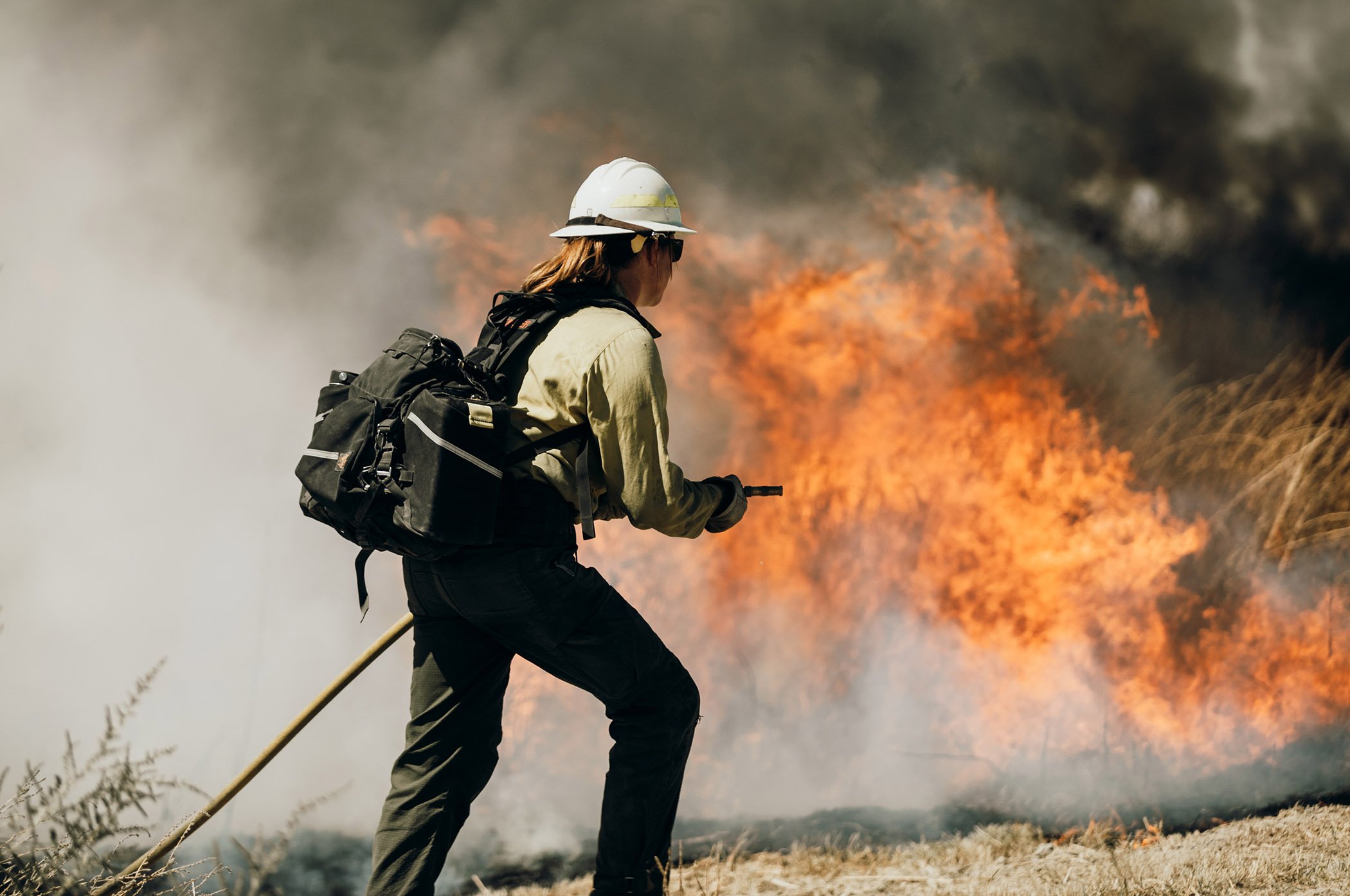
Fire season officially started in May for most of the United States, and current seasonal outlooks predict a substantial risk of large fires across much of the country, made even more dangerous by the ongoing coronavirus pandemic.
With public safety agencies anticipating a particularly difficult wildfire season, situational awareness for first responders and the public alike has become more important than ever.
Situational awareness is a decision making framework commonly used in emergency management to help individuals or organizations respond to incidents. Although there’s no official definition of the concept, it generally involves improving perception of your immediate environment, constructing mental models of the incident in its entirety, and creating actionable predictions based on those models.
In preparation for the summer, here are three publicly available, free resources to help you improve your situational awareness for wildfire season.
1. Perceiving your environment: Real-time weather data
For citizens, wildfire response is often difficult and chaotic. There are few official sources for real-time incident updates, and news reports can be inaccurate or outdated. The rapid spread of a fire forces many to make decisions on a moment’s notice or risk being caught in inescapable traffic.
Even among first responders, incident updates are usually only released at the start of each day and must be adapted on the field for changing conditions.
However, developing a more detailed understanding of your surrounding environment can help you better prepare for potential threats as they arise.
Wildfire spread is determined by a wide variety of factors like a region’s terrain, local vegetation (grasses vs shrubs, for example), or the concentration of buildings in a fire’s vicinity. Weather conditions are among the most substantial contributing factors and are some of the easiest to monitor without professional resources.
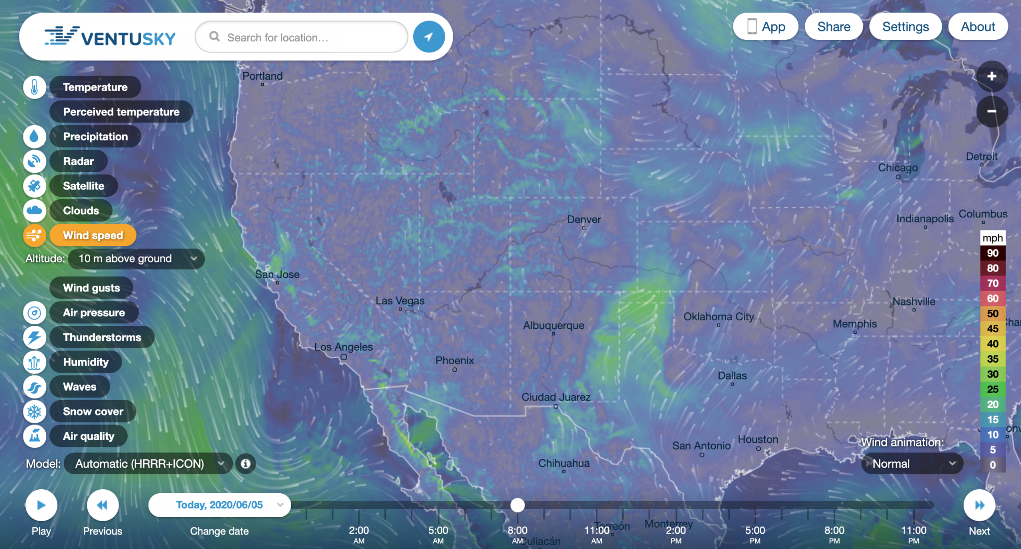
One particularly helpful resource for perceiving local weather conditions with greater nuance is Ventusky, a web application that provides real-time visualizations of weather data like temperature, precipitation, humidity, and wind speed and direction.
While even wildfire experts are unable to fully predict the course of a fire, knowing that your community is experiencing particularly high temperatures and low humidity could help you stay on high alert when fire risk is greatest. During an ongoing incident, tracking wind directions can help you navigate evacuation orders and stay away from a spreading fire.
2. Expanding your awareness: Ongoing fire incidents
A core tenet of situational awareness is moving beyond immediate perception of your environment in order to develop a mental model that incorporates peripheral information you might otherwise not have been aware of. For wildfire preparedness, this can mean expanding the scope of your awareness beyond the fires and risks in your immediate vicinity.
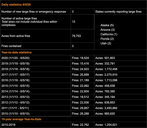
The National Interagency Fire Center (NIFC) provides daily fire incident updates for the entire United States, as well as year-to-date statistics noting the acres burned and number of fire incidents for a given season compared to each of the previous ten years. This data can help you situate perception of your local environment within a broader geographic and historic context.
The website organizes active fires by state and keeps track of the responding agency, total acres burned, containment percentage, and location, which allows you to track nearby threats as they develop.
Nationwide data also gives greater context to the overall fire risk, which can be important for evaluating resource availability and predicting potential shortages.
Fire departments rely heavily on mutual aid, or resource sharing between departments, when responding to major incidents. Many ongoing fires at one time will likely cause resources to be spread thin, making the risk of any one incident growing out of hand substantially greater.
Additionally, the annual fire data compiled by the NIFC helps translate the total number of fires or acres burned to a more tangible sense of what the upcoming fire season might look like. By analyzing year-to-date numbers alongside past fire seasons, you can better understand the relative risk compared to particularly devastating years like 2017 or 2018.
Additional resource: The Forest Service’s Active Fire Mapping Program displays large fire incidents on a map of the United States. Although the site includes less detail than the NIFC daily updates, it visually represents major fires so that incident locations and their relative proximity to each other are easier to recognize.
3. From awareness to preparedness: Wildfire risk predictions
While understanding wildfire risk day-by-day can keep you informed and help you take action when needed, wildfire preparedness requires advanced planning to mitigate future fire risks.
Wildfires are difficult to model due to the many factors that collectively determine a fire’s trajectory and destructive potential. They also often have relatively unpredictable origins such as fallen power lines, lightning strikes, chains dragging behind a vehicle, or out-of-control campfires.
In spite of this, the NIFC has established monthly seasonal outlooks which analyze weather patterns and fire activity to identify wildfire risk trends.
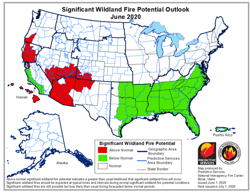
Every monthly outlook includes maps for each of the four months following its publication, marking geographic regions with either above or below average significant fire potential. The maps are supplemented by in-depth analyses of weather trends for each region, and how they translate to wildfire risk.
For fire management decision makers, these predictions can help determine when to implement preventative practices like controlled burns or begin recruiting and training new staff. For the public, this can help create a timeline for fireproofing homes or updating emergency kits and evacuation plans before the most dangerous points of wildfire season.
Additional resource: The National Weather Service has a Fire Weather site, which they use to warn people of potentially hazardous conditions that increase fire risk. The site includes an interactive map showing day-of weather events like wind advisories or red flag warnings, and several other external maps including the NIFC’s seasonal outlook risk map and the Active Fire Mapping Program.
By Trevor Greenan. Questions? Get in touch at tgreenan@perimeterplatform.com.


